
BasicShell

 Search
 820000509070000
|
-
Owners


Type Owner Ownership
Dates10001418
Deed
PrimaryDekker, Elizabeth F
215 W North St
Winterset IA 50273Start 07/21/2020
End
Legal Descriptions
DescriptionLOT 6, BLOCK 9 PITZER & KNIGHT
Value
Property Value Description Type & Category Value Taxable Acres CSRs Dwellings
&UnitsReason Land Land - Taxable 12,700 5,886 .00 .00 0 - 0 Buildings & Residential Dwellings Building - Taxable 193,800 89,812 .00 .00 1 - 0 Total 206,500 95,698 0.00 1 - 0
Recorded Documents
Grantor:1/Grantee:2
Type NameDocument Type
Legal DescBook
Page
Rec. Date
Inst. Date
Document1 Anderson Nicholas B
1 Anderson Anabel
2 Dekker Elizabeth FWarranty Deed 
2020
259307/21/2020
07/14/20202593 1 Berdine Ronald James
1 Berdine Sharon Elaine
2 Anderson Nicholas BWarranty Deed 2016
224208/02/2016
07/27/20162242 1 Housing & Urban Dev Secy
1 Matt Martin Real Est Mgmt Llc
2 Berdine Ronald James
2 Berdine Sharon ElaineWarranty Deed 2015
178506/29/2015
06/24/20151785 1 Wells Fargo Bank Na
2 Housing & Urban Dev SecyWarranty Deed 2015
62103/12/2015
10/08/2014621 1 Wachovia Bank Na
1 Courtney David
1 Madison County Mem Hosp
1 Wells Fargo Bank Na
1 Madison County Sheriff
2 Wells Fargo Bank NaSheriff's Deed 2014
275911/04/2014
10/21/20142759 1 Fishback Carole L
2 Courtney DavidWarranty Deed 2004
125003/24/2004
03/18/20041250
Tax Receipts
Property Tax
Year PayableReceipt
Number1st Half
Date Due1st Half
Amount2nd Half
Date Due2nd Half
AmountNotes 2023/2024  14307
1430709/30/2023 0.00 03/31/2024 0.00 -
Tax Calculation 2023-2024
159,600 Assessed Value X Roll Back Factor8 87,222 = Net Assessed Value (54.6504 Percent) 0 - Mitary Exemption 87,222 = Taxable Value 0.0417934 X 2023 Levy Rate (4.17934 Percent) 3,645.30 = Gross Taxes Due 0.00 - Homestead Credit 0.00 - Ag Land Credit 0.00 - Family Farm Credit 0.00 - Elderly Credit 0.00 - BPTC (Business Property Tax Credit) 0.00 - Future Payments 3,646.00 = Net Taxes Due The assessed value is set by the assessor. The assessed value is multiplied by a rollback factor resulting in the Net Assessed Value.
8The rollback factor varies for each parcel, consequently it is not possible to display a single rollback percentage. (The County Auditor can supply the actual rollback(s) for each parcel.)
The Military exemption (eligibility requirements), if any, is subtracted from the Net Assessed Value giving the Taxable Value.
The Levy Rate (%) is set annually by the state. Gross Taxes Due are calculated by multiplying the taxable value by the Levy Rate.
From the Gross Taxes Due several credits may be given. These include the Homestead Credit, Elderly Credit (determined by income), Agriculture Land Credit, and the Family Farm, (percent of value) credits.
Finally, any future payments are subtracted from the Gross Taxes Due. This yields the Net Taxes Due which are rounded to the nearest even dollar. Taxes are payable in two installments due on Sept 30, 2012 and on March 31, 2013
Tax History
Tax History
Receipt
Value
Taxable
Tax Due
Homestead
Military
FamFm
AgLand
Elderly
BPTC2023/2024 14307159,600 87,222 3,646.00 2022/2023 14267159,600 86,392 3,652.00 2021/2022 14198146,600 82,696 3,608.00 2020/2021 14105146,600 80,739 3,516.00 2019/2020 13677131,600 74,904 3,264.00 2018/2019 13592131,600 73,197 3,110.00 2017/2018 1381162,000 35,302 1,492.00 2016/2017 1349693,900 52,233 2,216.00 2015/2016 1349393,900 52,334 2,192.00 2014/2015 1374693,900 51,081 2,194.00 2013/2014 1373494,600 49,965 2,182.00 2012/2013 1364394,600 48,011 2,124.00 2011/2012 13662100,600 48,821 2,186.00 2010/2011 13808100,600 47,190 2,164.00 2009/2010 13813100,600 45,862 1,996.00 2008/2009 13794100,600 44,345 1,838.00 2007/2008 1374091,400 41,642 1,708.00 2006/2007 1367891,400 42,041 1,782.00 2005/2006 1362687,800 42,112 1,800.00 2004/2005 13734 87,800 42,544 1,658.00 168.58 2003/2004 13608 79,800 41,007 1,588.00 177.40 2002/2003 13658 79,800 41,230 1,584.00 187.65 2001/2002 13544 68,200 38,373 1,346.00 194.70 2000/2001 13462 46,300 25,397 992.00 1999/2000 13417 42,800 24,173 724.00 181.70 1998/1999 13440 42,800 23,501 662.00 172.34 1997/1998 13318 37,500 22,060 790.00 1996/1997 13112 37,500 22,244 798.00 1995/1996 13010 31,300 21,130 786.00 1994/1995 12965 31,300 21,296 810.00 1993/1994 12900 29,200 21,228 840.00 1992/1993 12853 22,440 16,395 440.00 n/a 1991/1992 12799 19,510 15,503 390.00 n/a 1990/1991 13433 19,510 15,578 378.00 n/a 1989/1990 12747 19,510 15,732 366.00 n/a
Tax Distribution
Taxing
AuthorityPercent of
Tax DollarsDollars
CurrentDollars
Last YearCounty Wide
CurrentCounty Wide
Last YearCounty Wide
Inc/DecPercent
Inc/DecWinterset Sch 38.619% 1,408.03 1,466.01 10,082,520.00 10,454,051.00 -371,531.00 -3.553% Winterset Corp 38.228% 1,393.80 1,427.33 3,351,332.00 3,543,141.00 -191,809.00 -5.413% County 13.391% 488.25 420.27 5,894,837.00 5,036,532.00 858,305.00 17.041% Hospital 6.614% 241.13 228.12 2,900,142.00 2,721,613.00 178,529.00 6.559% Dmacc-area 11 1.780% 64.91 59.99 41,019,999.00 36,929,401.00 4,090,598.00 11.076% Assessor .758% 27.64 28.35 332,420.00 338,254.00 -5,834.00 -1.724% Ag Extension .606% 22.08 21.72 265,552.00 259,171.00 6,381.00 2.462% Brucellosis .004% 0.16 0.21 354,498.00 462,458.00 -107,960.00 -23.344% Tax Distribution Chart
Tax History Chart
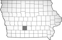
Map
Information current through close of business 04/24/2024
This site designed, developed, hosted and maintained by "Solutions", Inc.Disclaimer: Every effort is made to insure accurate information is posted to this site.
The server processed this request in 0.35 seconds
However, County does not warrant or guarantee the accuracy, reliability or timeliness of the content on this site or content which is referenced by or linked to this site.
Redistribution of data from this site for commercial purposes is strictly prohibited.
BISON
