
BasicShell

 Search
 820003501040000
|
-
Owners


Type Owner Ownership
Dates9998500
Deed
PrimaryBoston, Brock & Aurora
721 N 6th St.
Winterset IA 50273Start 12/09/2016
End
Legal Descriptions
DescriptionLOT 1 BLOCK 1 DANFORTH'S SECOND
Value
Property Value Description Type & Category Value Taxable Acres CSRs Dwellings
&UnitsReason Land Land - Taxable 14,400 6,673 .00 .00 0 - 0 Buildings & Residential Dwellings Building - Taxable 166,700 77,253 .00 .00 1 - 0 Total 181,100 83,927 0.00 1 - 0
Recorded Documents
Grantor:1/Grantee:2
Type NameDocument Type
Legal DescBook
Page
Rec. Date
Inst. Date
Document1 Rivera Ryan J
1 Rivera Marianne
2 Boston Brock
2 Boston AuroraWarranty Deed 
2016
376512/09/2016
12/01/20163765 1 Josephs Properties Llc
2 Rivera Ryan JQuit Claim Deed 2016
31902/05/2016
07/07/2015319 1 West Bank
2 Josephs Properties LlcWarranty Deed 2014
314012/15/2014
12/15/20143140 1 West Bank
1 Madison County Sheriff
1 Moore Joel H
1 Moore Kristine R
1 Winterset City Of
2 West BankSheriff's Deed 2014
302012/01/2014
11/07/20143020 1 Jpmorgan Chase Bank Tr
2 Moore JoelWarranty Deed 2005
479010/04/2005
09/22/20054790
Tax Receipts
Property Tax
Year PayableReceipt
Number1st Half
Date Due1st Half
Amount2nd Half
Date Due2nd Half
AmountNotes 2023/2024  14020
1402009/30/2023 0.00 03/31/2024 0.00 -
Tax Calculation 2023-2024
138,200 Assessed Value X Roll Back Factor8 75,527 = Net Assessed Value (54.6505 Percent) 0 - Mitary Exemption 75,527 = Taxable Value 0.0417934 X 2023 Levy Rate (4.17934 Percent) 3,156.53 = Gross Taxes Due 0.00 - Homestead Credit 0.00 - Ag Land Credit 0.00 - Family Farm Credit 0.00 - Elderly Credit 0.00 - BPTC (Business Property Tax Credit) 0.00 - Future Payments 3,156.00 = Net Taxes Due The assessed value is set by the assessor. The assessed value is multiplied by a rollback factor resulting in the Net Assessed Value.
8The rollback factor varies for each parcel, consequently it is not possible to display a single rollback percentage. (The County Auditor can supply the actual rollback(s) for each parcel.)
The Military exemption (eligibility requirements), if any, is subtracted from the Net Assessed Value giving the Taxable Value.
The Levy Rate (%) is set annually by the state. Gross Taxes Due are calculated by multiplying the taxable value by the Levy Rate.
From the Gross Taxes Due several credits may be given. These include the Homestead Credit, Elderly Credit (determined by income), Agriculture Land Credit, and the Family Farm, (percent of value) credits.
Finally, any future payments are subtracted from the Gross Taxes Due. This yields the Net Taxes Due which are rounded to the nearest even dollar. Taxes are payable in two installments due on Sept 30, 2012 and on March 31, 2013
Tax History
Tax History
Receipt
Value
Taxable
Tax Due
Homestead
Military
FamFm
AgLand
Elderly
BPTC2023/2024 14020138,200 75,527 3,156.00 2022/2023 13980138,200 74,808 3,162.00 2021/2022 13902128,800 72,656 3,170.00 2020/2021 13859128,800 70,936 3,090.00 2019/2020 13816117,700 66,992 2,920.00 2018/2019 13734117,700 65,465 2,782.00 2017/2018 14949103,300 58,818 2,484.00 2016/2017 14995103,300 57,462 2,438.00 2015/2016 14246103,300 57,573 2,130.00 203.13 1,852 2014/2015 14568103,300 56,195 2,126.00 208.26 1,852 2013/2014 14560105,600 55,774 2,142.00 211.76 1,852 2012/2013 14786105,600 53,593 2,122.00 167.41 1,852 2011/2012 14776107,100 51,975 2,106.00 136.77 1,852 2010/2011 14631107,100 50,240 2,078.00 142.37 1,852 2009/2010 14638107,100 48,826 1,890.00 154.02 1,852 2008/2009 14619107,100 47,210 1,734.00 144.70 1,852 2007/2008 14559100,200 45,650 1,872.00 2006/2007 14495100,200 46,088 1,954.00 2005/2006 1444389,600 42,976 1,838.00 2004/2005 14556 89,600 43,416 1,694.00 168.58 2003/2004 14430 81,500 41,880 1,624.00 177.40 2002/2003 14479 81,500 42,109 1,622.00 187.65 2001/2002 14361 83,000 46,700 1,680.00 194.70 2000/2001 14275 83,000 45,528 1,588.00 189.41 1999/2000 14225 76,800 43,376 1,444.00 181.70 1998/1999 14246 76,800 42,170 1,326.00 172.34 1997/1998 14124 67,400 39,651 1,246.00 173.56 1996/1997 13918 67,400 39,981 1,260.00 173.83 1995/1996 13817 56,200 37,940 1,232.00 180.54 1994/1995 13771 56,200 38,238 1,270.00 184.46 1993/1994 13704 52,500 38,166 1,510.00 1992/1993 13656 58,320 42,610 1,440.00 n/a 1991/1992 13607 50,710 40,296 1,230.00 n/a n/a 1990/1991 12424 50,710 40,491 1,192.00 n/a n/a 1989/1990 13553 50,710 40,892 1,150.00 n/a n/a
Tax Distribution
Taxing
AuthorityPercent of
Tax DollarsDollars
CurrentDollars
Last YearCounty Wide
CurrentCounty Wide
Last YearCounty Wide
Inc/DecPercent
Inc/DecWinterset Sch 38.619% 1,218.80 1,269.31 10,082,520.00 10,454,051.00 -371,531.00 -3.553% Winterset Corp 38.228% 1,206.48 1,235.82 3,351,332.00 3,543,141.00 -191,809.00 -5.413% County 13.392% 422.64 363.87 5,894,837.00 5,036,532.00 858,305.00 17.041% Hospital 6.613% 208.72 197.51 2,900,142.00 2,721,613.00 178,529.00 6.559% Dmacc-area 11 1.780% 56.19 51.95 41,019,999.00 36,929,401.00 4,090,598.00 11.076% Assessor .758% 23.92 24.55 332,420.00 338,254.00 -5,834.00 -1.724% Ag Extension .606% 19.11 18.81 265,552.00 259,171.00 6,381.00 2.462% Brucellosis .004% 0.14 0.18 354,498.00 462,458.00 -107,960.00 -23.344% Tax Distribution Chart
Tax History Chart
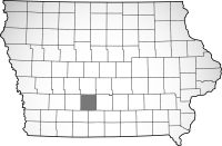
Map
Information current through close of business 04/17/2024
This site designed, developed, hosted and maintained by "Solutions", Inc.Disclaimer: Every effort is made to insure accurate information is posted to this site.
The server processed this request in 0.18 seconds
However, County does not warrant or guarantee the accuracy, reliability or timeliness of the content on this site or content which is referenced by or linked to this site.
Redistribution of data from this site for commercial purposes is strictly prohibited.
BISON
